Mapping & Volumetrics
Audit-ready stockpile volumes from $399, survey-grade, processed in DroneDeploy, measured from the air in a fraction of a crew's time.
Survey-grade aerial mapping with ground control points, stockpile volume reports for yards and quarries, topo and orthomosaic maps for engineers and planners.
Choose a package
Pick a package, add extras if you want them, check out. Everything is one-time unless it's marked /mo or /yr.
Deliverables, not just pretty pictures.
Stockpile volume report
Cubic-yard volumes per pile, computed from the point cloud, inventory numbers your accountant and your buyer both trust. On stockpile orders.
Georeferenced orthomosaic
A distortion-corrected, measurable aerial base map of the whole site, GeoTIFF ready for CAD and GIS.
Topo & contour surface
Elevation model with contours for grading, drainage and design work, RTK + GCP accuracy of 1–3 cm horizontal. On topo orders.
CAD/GIS-ready files
GeoTIFF, LAZ point clouds and contour exports that import straight into AutoCAD, Civil 3D and GIS platforms.
This is a real capture, from a real job.
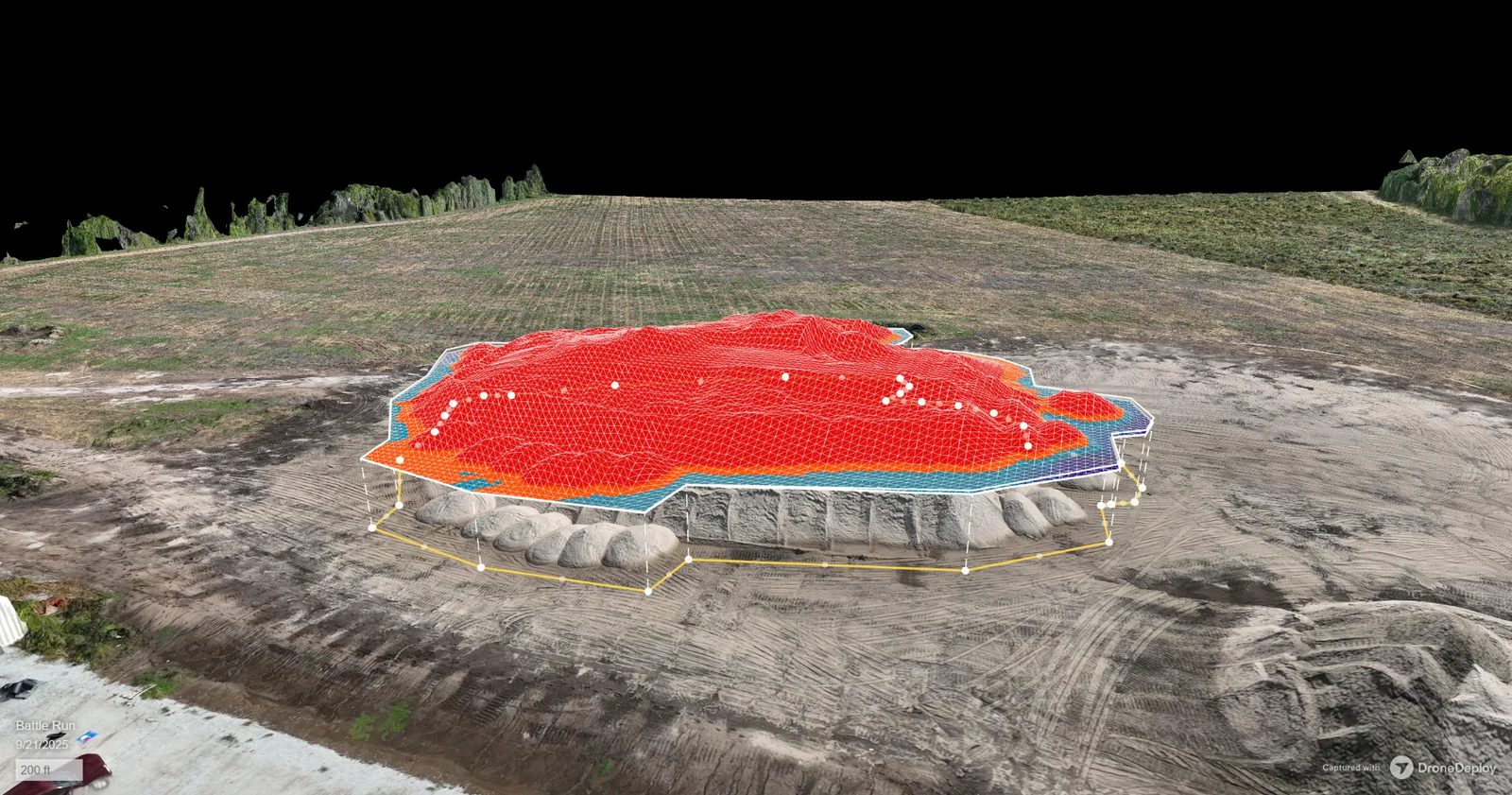
That red mesh is the measurement. The drone maps the pile's exact surface in 3D, we draw the base, and the software computes cubic yards against it, down to the last scoop the loader took out of the face. Nobody climbs the pile, and the whole yard measures in one flight.
Survey-grade numbers, no survey crew.
Questions we get a lot.
How accurate are the volumes?
Flights use ground control points and RTK positioning, typically 1–3 cm horizontal, 2–5 cm vertical. Volume numbers hold up in an audit.
Can you do this monthly?
That's the sweet spot, same piles, same flight plan, every month, so your inventory numbers are always current. The monthly subscription is the cheapest way to buy it.