REC40.8136°N 96.7026°WVirtual Site DocumentationALT 120 FTPART 107
← All services

Aggregate & Concrete Yards

Know exactly what's in your yard, every month.

Monthly stockpile volumes for ready-mix and aggregate yards, audit-ready cubic yards, tracked over time, from $349/mo. Stockpile software alone runs $500/mo and you still do the measuring; we fly, measure in DroneDeploy, and report for less.

Recurring stockpile surveys built for ready-mix concrete plants, sand-and-gravel pits, and aggregate yards. Same piles, same flight plan, every month, so your material inventory is always current and reconcilable. We keep every survey on file, so you can compare month over month, catch shrinkage, and reconcile booked vs. actual tonnage at close.

// Straight off our flights

This is a real capture, from a real job.
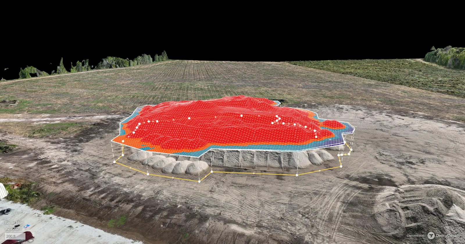
DroneDeploy 3D volume measurement of a sand stockpile captured by VSD Pros, a red elevation mesh overlays the pile with the measured base outline drawn around it
Live VSD Pros capture: Stockpile volume measurement, sand pile, 3D site model
What you're looking at

This is how your piles get measured: the drone builds a 3D model of the yard, we outline each pile's base, and the software computes cubic yards from the actual surface, dated, repeatable, and the same method every month, so the history is apples to apples.

Report within 48 hours of each flight
// What this is

Yard inventory that is never stale.

Every pile measured from the air, same flight plan every month, so month-end close, audits and reorders run on real cubic yards instead of eyeballed estimates. The history stays on file, so shrinkage has nowhere to hide.

What lands in your inbox

You get a per-pile cubic-yard report, a month-over-month history log, an ERP-ready CSV, and a yard orthomosaic.

Report within 48 hours of each flight
// What you get

Deliverables, not just pretty pictures.

01

Per-pile volume report

Cubic-yard volume for every stockpile, by product grade, the number your month-end close and your auditor both trust.

02

Month-over-month history

Every survey kept on file, so you compare against last month, catch shrinkage, and reconcile booked vs. actual tonnage.

03

Reconciliation exports

CSV and PDF built to drop into your ERP or accounting, volume, density, and tonnage per product.

04

Georeferenced yard map

An orthomosaic and surface model of the whole yard for placement, material flow, and space planning.

// Book it

Choose your program

Pick a package, add extras if you want them, check out. Everything is one-time unless it's marked /mo or /yr.

What you'll receiveDelivered in Report within 48 hours of each flight
Per-pile volume report
Month-over-month history
Reconciliation exports
Georeferenced yard map

You'll get it as a per-pile cubic-yard report, a month-over-month history log, an ERP-ready CSV, and a yard orthomosaic, so you know exactly what you're paying for before we ever fly.

01: Pick your package
02: Or go on a plan
Booking us regularly?See all membership plans & dealsLearn more →

The smaller members price = the member rate: what the same job costs once you're on any membership plan.

03: Add to your program
Selected$349/mo
per month · plus any one-time add-ons
Pay by bank at checkout, save ~3%
Weather kills the window? Reschedule’s free — can’t fly at all, full refund.
Skip to checkout →
// Good to know

Questions we get a lot.

How accurate are the volumes?

With RTK positioning and ground control, drone stockpile volumes land within about 1–3% of survey-grade, accurate enough to reconcile against tonnage records and hold up in an audit.

How often should we fly?

Monthly is the sweet spot for most plants; high-turnover yards go weekly. Same piles, same flight plan every time, so the numbers are comparable.

Do you keep our data?

Yes, every survey is archived, so you always have the history to compare against and pull for audits or lenders.

Added to cartCheckout →